Calendar 2013
Special places in Cragg Vale
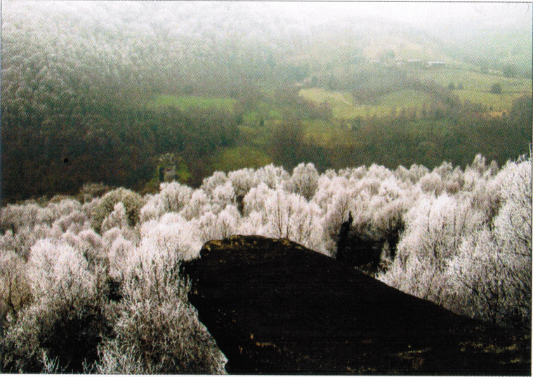
 Photographed by Kevin Cutts. The scramble op Robin Hood rocks rewards you with some of the best views of Cragg Vale. Children play hide and seek in the rocks, and rock climbers practise their skills here. look out for the unfinished mill stones and the carvings of names and dates from 100 years ago.
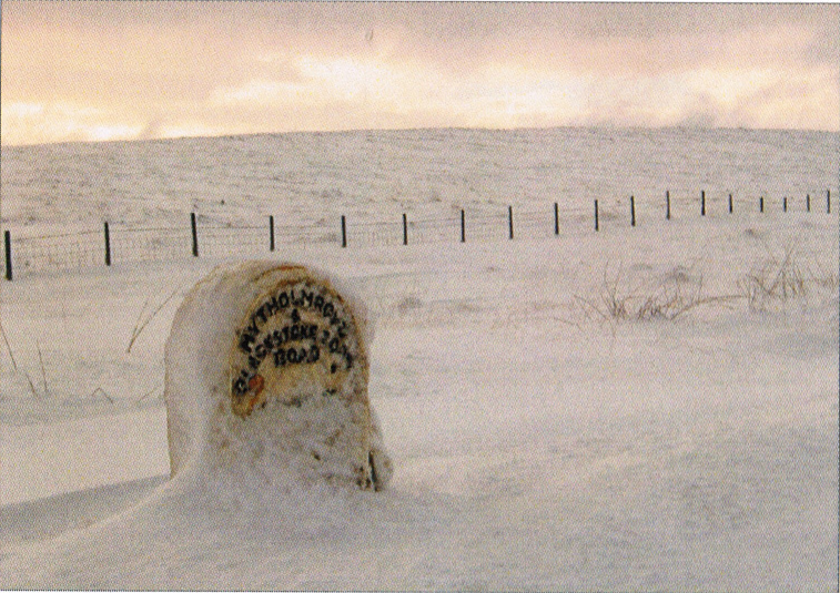
 Photographed by Roy Collinge. In 1797 it became compulsory to put milestones on all turnpike roads. This was to inform travellers of direction and distance, to help coaches keep to schedule, and for charging for change of horses at coaching inns. Distances on mileposts were also used to calculate postal charges before the uniform postal rate was introduced in 1840. When Turnpike trusts were wound up in 1888, the West Riding County Council became responsible for the roads. All the original mileposts were replaced by cast iron triangular ones.
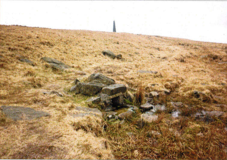
 Photographed by Paul Frechette. Situated on the Pennine Way, north of stoodley Pike, is a remarkable spring which discharges its water into a small stone trough. What makes this spring unique and interesting is that at 360 metres above sea-level, it is one of the highest spring sources in Cragg Vale. Yet the spring delivers a constant flow at all times in all conditions. In 1995, during the worst drought on record in Yorkshire, when most of the reservoirs were dry, and other springs at lower levels stopped running, this spring continued to flow unaffected.
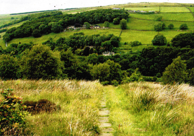
 Photographed by Kevin Cutts. Now part of the Calderdale Way, this path was flagged for weavers, spinners, and mill workers going to work in Cragg Vale's mills. You can see the concave shape of the stones where the clogs of the mill workers wore away the millstone grit. Originally this path was part of an ancient route from Sowerby, down to Marshaw Bridge, crossing Turvin Brook and continuing past Red dykes to Withens Gate, Mankinholes and Lancashire.
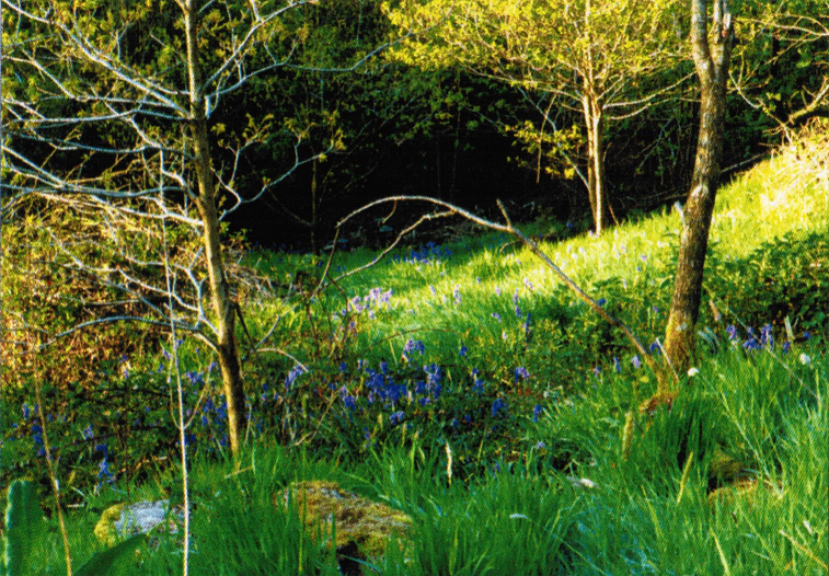
 Photographed by Roy Collinge. Bluebells in springtime are a delight in Cragg vale. Here they are magnificent in dappled sunlight beneath the beach trees in Cragg Hall Wood.
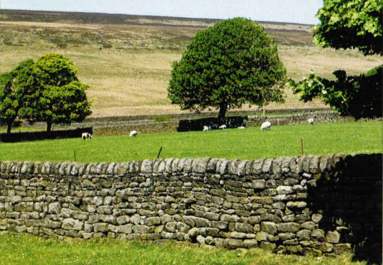
 Photographed by Roy Collinge. Sheep grazing peacefully at Sykes Gate Farm. The pastoral nature of the drystone walls, well cropped grass, and shade offered by the trees is a vivid contrast to the stark nature of the moorland backdrop.
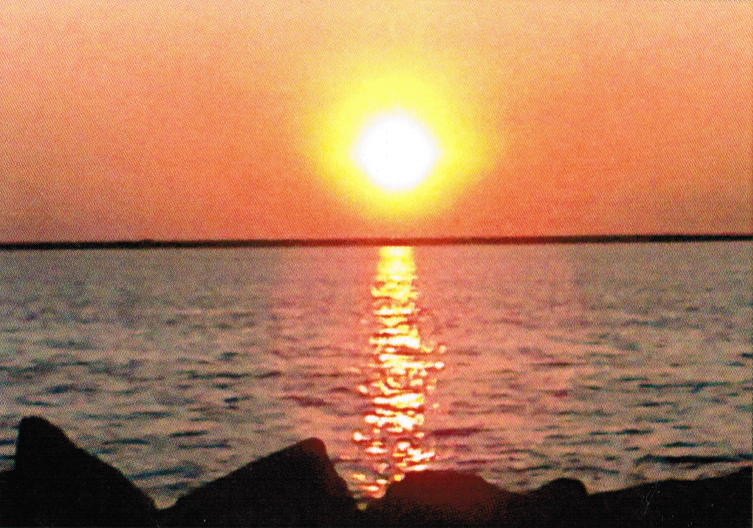
 Photographed by Roy Collinge. Blackstone Edge reservoir provides spectacular and ever changing scenery at all times of the year and at different times of the day. sunsets are particularly dramatic with the sun dropping over the embankment in a matter of seconds. The reservoir can be found at the top of the longest continuous gradient (968 feet over 5 miles) in england that runs through Cragg Vale. A challenge that is popular with cyclists.
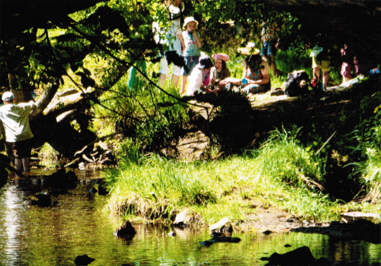
 Photographed by Roy Collinge. Our very own 'Cragg Beach' in the middle of the village beside New Bridge, on the path between Castle Gate and Marshaw Bridge. this has always been a popular place for recreation, be it a gentle stroll by the river, or a picnic and a paddle.
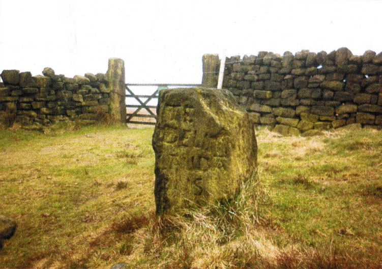
 Photographed by Paul Frechette. This stone, most likely a Marker stone, is inscribed with a cross and the Latin inscription of 'Te Deum Laudumus' ('We Praise Thee, O Lord'). Long ago the stone was regarded as sacred. coffins were rested here and prayers spoken, during long journeys along the pack-horse route over the moors from Cragg Vale to the 'local' parish church of Heptonstall, or possibly the chapels at Lumbutts or Mankinholes.
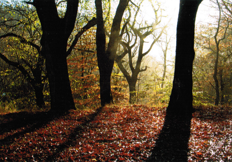
 Photographed by Brierley Hellowell. A lovely Mid-Autumn day near Broadhead Clough Nature Reserve, with the sun shining through the trees, reflecting on the sparkling carpet of golden russet leaves.
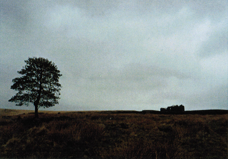
 Photographed by Jenny May. The bleakness of the moors over by Withens clough captured through the starkness of the lone tree and the outline of the ruined Red Dykes farm.
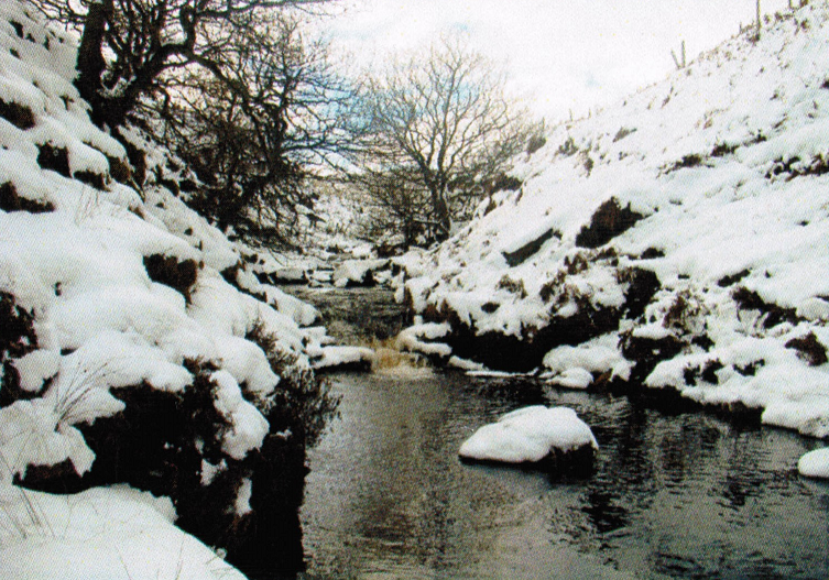
 Photographed by Kevin Cutts. Wash Falls, or Wash Fold, has been a favourite spot for generations of children for swimming and sliding down the waterfalls. Originally the pools are said to have been used for washing sheep.